November Editorial
Can atomic clocks be used to survey Earth’s interior?

November Editorial
Can atomic clocks be used to survey Earth’s interior?
|
When we think about atomic clocks we do not instinctively think of using it to survey the Earth’s geoid. In fact many of us think about the earth’s geoid so seldom that a reminder might be in order. The geoid is the shape that the earth would be if the continents were at exactly sea level and all the seas were perfectly flat instead of sloshing about with tides and currents. Until we know this, it's is hard to say - for instance - exactly how high a given mountain is above sea-level. Measuring the geoid has proven a challenge but if astrophysicists Philippe Jetzer and Ruxandra Bondarescu from the University of Zurich have their way atomic clocks might be up to the job in the next decade or so.
|
The Earth’s geoid can only be measured indirectly because it is mean sea level plus the natural continuation of mean sea level under the landmass. Since there’s no way of moving the continents out of the way, this extension must be determined mathematically or modelled. The geoid model is actually based on gravity-data collected from around the world. At present satellites do the distance measurements and derive the gravity field to provide geoid maps over the entire globe. But this is a complex task because for measurements to be meaningful, calibration and extensive computations are required. Even then choosing the right surface is complicated - how do you know when something is at average sea level? - and the spatial resolution of the geoid computed this way is poor - approximately 100 km. |
|
|
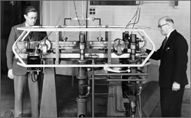
So back to atomic clocks. Atomic clocks are the most accurate means yet discovered of measuring time. This is done by the vibrations within atoms. The United State’s standard atomic clock known as NIST-F1 is believed to be so accurate that it would neither gain nor lose a second in 30 million years. But how can any clock, however accurate, be used to survey the Earth’s geoid? The idea is not as far-fetched as as it seems at first glance. The idea of using the clocks for mapping purposes is based on a view of general relativity that has been discussed for the past 30 years. Clocks tick at different rates when placed at different distances from a body with considerable mass (that mass being, for instance, our Earth) The closer a clock is to a heavy underground mass, the slower it ticks, so a clock positioned over a lode of iron ore will tick more slowly than one that sits above an empty cave. The difference is miniscule, but measurable. According to Ruxandra Bondarescu, the main author of the latest paper in the Geophysical Journal International (see reference below), if an atomic clock is placed at sea level (defining sea level as the exact altitude of the geoid ), and a second clock is placed anywhere in the continent, as long as those two clocks can be synchronized, the second clock will tick faster or slower depending on whether it is above or below the geoid. This local measurement of the geoid can then be combined with other geophysical measurements to give a better read of the underground structure. By using synthetic calculations based on computer models, the authors demonstrated that atomic clocks can give a meaningful reading of a geoid perturbation caused by a 1.5 km radius sphere with a 10 % density difference, even with the sphere buried 2 km in the Earth’s crust. So in principle, surveying underground to great depth by atomic clock is possible, provided that the heavy underground structure to be studied is large enough to measurably affect the tick rates. The only drawback is that the present generation of atomic clocks can’t be transported to the field - they are too large and delicate to be used outside a lab. But this may change in the next few years. A number of companies and research institutes are already working on the development of portable ultra-precise atomic clocks. But till that time, the existing lab-based atomic clocks will keep ticking. They already give us the precise readings needed for the earth’s global positioning system navigation (GPS), the co-ordination of Internet servers and Coordinated Universal Time (UTC). Soon they will also help us to determine the exact shape of the planet we live on. Journal Reference:
| |
| _______________________________ | ||||
| Home | | | Shopping | | | Database |
© Biscuit Software 2004-2015
All rights reserved